


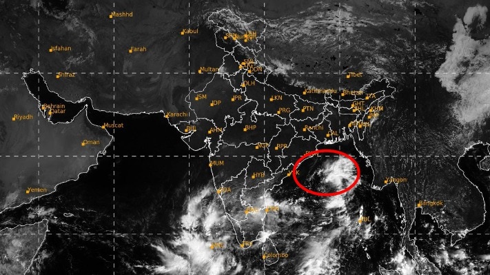
A weather system developing over the Bay of Bengal has strengthened into a low-pressure area and is expected to intensify into a cyclone over the coming days, potentially bringing changing weather conditions along India's eastern coast. The India Meteorological Department, in a special bulletin issued on Friday, October 23, stated that the system formed at 5:30 am over the east-central and adjoining southeast Bay of Bengal.
The system is projected to move west-northwestwards towards the coasts of north Andhra Pradesh and adjoining south Odisha as it grows stronger. This forecast places the eastern coastline on alert while meteorologists track the system's movement and intensity. However, the meteorological agency has not yet confirmed a specific landfall location or whether it will make direct landfall.
According to the department, the low-pressure area is very likely to intensify into a depression by October 24 and strengthen further into a deep depression by October 25. The system is then expected to evolve into a cyclonic storm over the west-central Bay of Bengal by the morning of October 26.
Following that stage, the system is forecast to continue tracking west-northwestwards towards north Andhra Pradesh and adjoining south Odisha, intensifying further over the following two days. A depression is characterized by falling air pressure and strengthening winds, which can develop into a cyclone if atmospheric conditions remain favourable.
This latest update follows an earlier warning issued when a cyclonic circulation was active over the southeast and adjoining east-central Bay of Bengal. October falls within the post-monsoon cyclone season in the region, during which weather systems frequently gather strength over warm ocean waters.
Authorities are continuously monitoring the system as it traverses the Bay of Bengal. Further details regarding its exact movement, ultimate intensity, and potential impact on the coastline are expected to emerge as the system matures.