


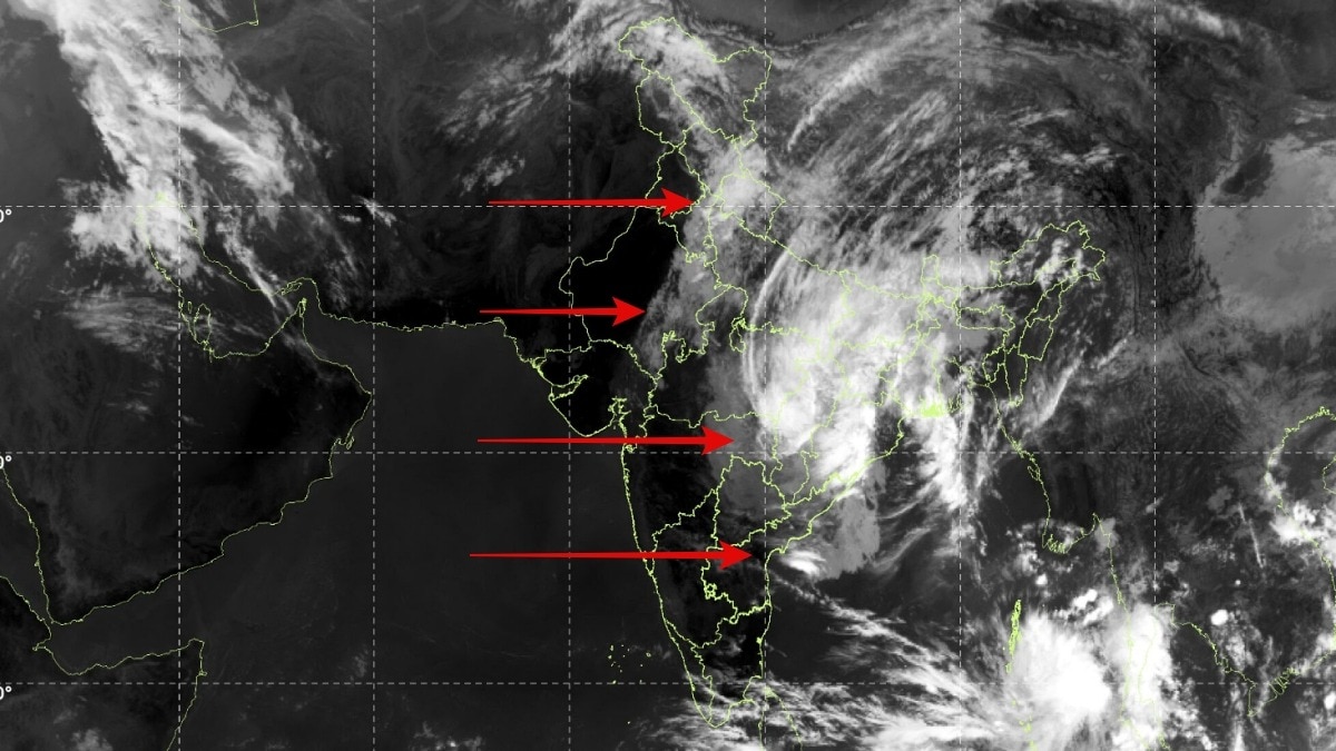
Satellite imagery has captured Cyclone Arnab's vast cloud shield spreading across India after its Andhra Pradesh landfall. The weakening system continues to carry heavy rainfall risks across several states.The IMD expects the depression to continue moving northwards and weaken further into a well-marked low-pressure area.
Cyclone Arnab may have weakened after making landfall along the Andhra Pradesh coast, but its sprawling cloud bands continue to influence weather across large parts of India.Latest satellite images have captured the vast cloud shield stretching across the subcontinent as the remnants of the very severe cyclonic storm move inland, bringing heavy rainfall threats to several states.The India Meteorological Department (IMD) said the deep depression, the remnant of Cyclone Arnab, weakened into a depression as it moved nearly northwards at around 22 kmph over the previous six hours.At 5:30 am IST on October 29, the system was centred over south Chhattisgarh and adjoining south Odisha. IMD The system was located approximately 20 km west of Jagdalpur in Chhattisgarh, 210 km southwest of Titlagarh in Odisha and 250 km south of Raipur.The IMD expects the depression to continue moving northwards and weaken further into a well-marked low-pressure area by the evening of October 29.
Doppler weather radars at Raipur and Sambalpur are keeping the system under continuous surveillance. SATELLITE CAPTURES THE STORM'S SPRAWLING REACHThe satellite image shows a broad mass of clouds extending from eastern and central India towards the northern parts of the country, illustrating how a cyclone's influence can persist long after its centre crosses the coastline.The bright cloud clusters indicate regions of extensive cloud cover and potentially deep convection.
As the system moves inland, its circulation continues to transport moisture, fuelling rainfall across areas far removed from its landfall location.The image also shows a separate cloud system over the Andaman Sea associated with a low-pressure area, highlighting the developing weather activity over the eastern Indian Ocean.SEVERAL STATES BRACE FOR HEAVY RAINFALLThe IMD has warned of heavy to very heavy rainfall in parts of central, eastern and northern India as the system weakens.Chhattisgarh could see heavy to very heavy rainfall at a few places in its northern districts on October 29. Jharkhand is also likely to receive heavy to very heavy rainfall at isolated places.
Ventusky Bihar faces a risk of heavy to very heavy rainfall at isolated locations on October 29 and 30, while east Uttar Pradesh could experience heavy to very heavy rainfall on October 29, with rainfall warnings continuing in parts of the state over the following two days.Heavy rainfall is also forecast in interior Odisha, eastern Vidarbha, east Madhya Pradesh and parts of West Bengal. Sub-Himalayan West Bengal and Sikkim could receive heavy rainfall on October 29 and 30.Although Arnab is weakening, the continuing rainfall threat highlights why a cyclone's impact can extend well beyond landfall.- Ends