


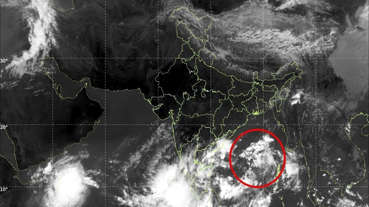
An Andaman Sea circulation is likely to form a low-pressure area over the Bay of Bengal on 23 October 2026. Its expected intensification has put India's eastern coast on watch, though no cyclone or landfall is confirmed.The system is very likely to move further west-northwestwards.
A developing weather system over the Andaman Sea could mark the beginning of a fresh cyclonic threat over the Bay of Bengal, with a low-pressure area likely to form on October 23, 2026.The system is expected to move west-northwestwards and intensify further, putting coastal regions on watch as meteorologists track its development.According to the latest weather update, an upper-air cyclonic circulation over the North Andaman Sea moved west-northwestwards and lay over the North Andaman Sea, off the Andaman Islands, at 5:30 am IST on October 22.The system is very likely to move further west-northwestwards, under whose influence a low-pressure area is expected to develop over the southeast and adjoining east-central Bay of Bengal around October 23. The weather system is then likely to continue moving west-northwestwards and intensify further.
However, its eventual strength, trajectory and potential impact on the Indian coastline will depend on how it develops over the coming days.COULD THE SYSTEM BECOME A TROPICAL CYCLONE?Low-pressure areas are common weather systems over tropical oceans. They can intensify when warm sea-surface temperatures, sufficient atmospheric moisture, and favourable wind patterns support the development of organised thunderstorms.
If the system strengthens into a well-organised depression and continues intensifying, it could potentially develop into a tropical cyclone. However, the formation of a low-pressure area alone does not confirm that a cyclone will develop.The Bay of Bengal is particularly vulnerable to tropical cyclones during the post-monsoon season, which typically extends from October to December.
Warm ocean waters and favourable atmospheric conditions can help weather systems strengthen during this period.WHAT DOES IT MEAN FOR INDIA?The west-northwestward movement of the developing system makes its future trajectory important for India's eastern coastline. Depending on its eventual path and intensity, parts of the eastern coast could experience heavy rainfall, strong winds and rough sea conditions.The Andaman and Nicobar Islands could also be affected by weather associated with the developing system.At this stage, however, there is no confirmed landfall location or indication of which coastal states could face the greatest impact.
Forecasts will become clearer as the system develops and meteorological agencies assess its movement.Authorities and coastal communities will need to monitor subsequent updates from the India Meteorological Department (IMD) for any changes in the system's intensity, track and potential impact.For now, the developing circulation remains a weather system to watch, with the next few days likely to be crucial in determining whether it evolves into a tropical cyclone threatening the Indian coast.- Ends