


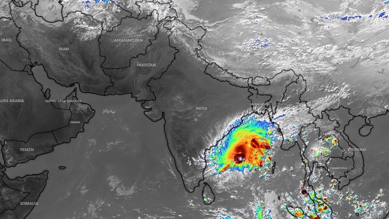
Cyclone Akvan, now over the central south and adjoining westcentral Bay of Bengal, is expected to strengthen before approaching the Andhra Pradesh coast.In its November 17 advisory, the India Meteorological Department (IMD) said it could become a severe cyclonic storm by Tuesday evening and a very severe cyclonic storm by November 19. Vehicles ply on a road amid heavy rainfall triggered by Cyclone Arnab in Odisha.
Akvan is forecast to cross the Andhra Pradesh and Yanam coasts between Nellore and Tuni around 11:30 am on November 20, with sustained winds of 120-130 kmph and gusts up to 145 kmph.It is also the third cyclone to develop over the Bay in weeks, after Arnab, which made landfall on October 28, and Murasu, which crossed the Andhra coast on November 3. The sequence of back-to-back cyclones leads to the obvious question of what's behind this stormy spell.
The answer, as it stands, may lie in the Pacific. A graphic illustrating the warming impact of El Nino.
IS EL NINO BEHIND BACK-TO-BACK CYCLONES?El Nino, the periodic warming of the central and eastern equatorial Pacific, can alter atmospheric circulation far beyond the Pacific. The northeast monsoon tends to be more vigorous during El Nino years, and, more rain over southern India can coincide with more low-pressure-area days over the Bay, some of which may develop into cyclones.El Nino, however, is not acting alone.Indian Ocean warming and the Madden-Julian Oscillation (MJO) also influence conditions over the Bay.
The MJO is a moving pulse of clouds, rainfall and winds across the tropics.The IMD’s latest advisory noted that it is favouring enhanced convective activity over the Bay between November 16 and 21. A satellite image shows Cyclone Akvan brewing in the Bay of Bengal.
WHAT MAKES A CYCLONE GAIN STRENGTH?It's also a scientifically proven fact that cyclones draw energy from warm ocean water.Evaporation supplies moisture as rising air condenses into clouds, releasing heat that strengthens the storm.Low vertical wind shear, a term for little change in wind speed or direction with height, also helps thunderstorms stay organised around the cyclone’s centre. A satellite image shows Cyclone Akvan over the Indian subcontinent.
These factors can accelerate intensification, but do not prove El Nino alone caused Akvan.But then this third cyclone's development comes as El Nino continues to break ocean warming records, with its peak yet to come.- Ends