


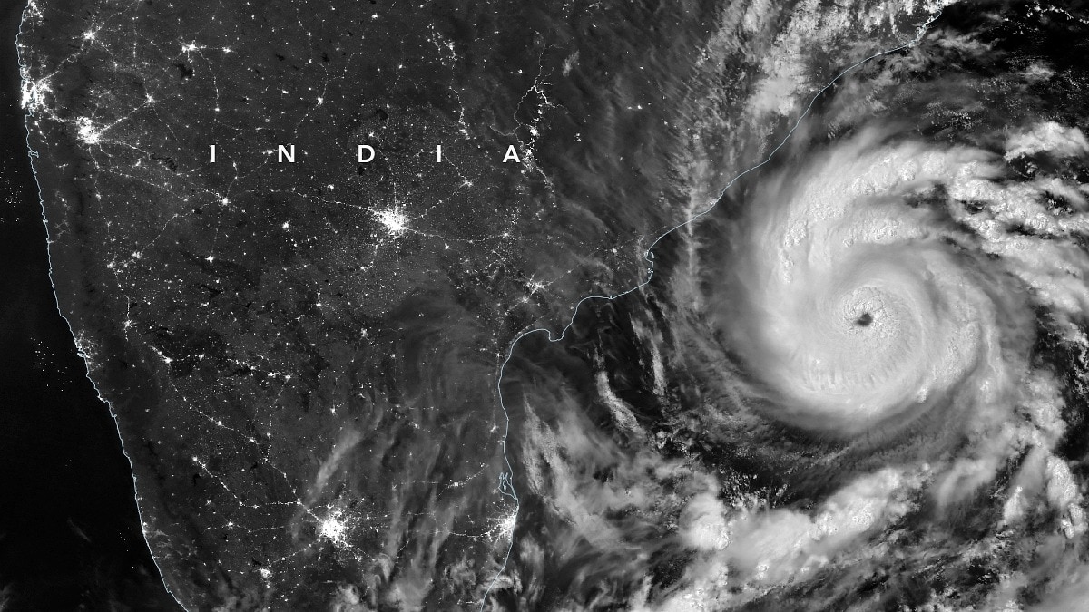
When Cyclone Arnab made landfall on the intervening night of August 27-28, over 1,80,000 people had already been evacuated across Andhra Pradesh and Odisha, Isro satellites tracked its movement, IMD issued notifications and early warnings, national and state disaster response units were on standby.India’s east coast has spent more than a decade building a network of cyclone-warning systems, weather radars, evacuation shelters and disaster-response teams to reduce the damage caused by powerful storms.But less than a week after Cyclone Arnab stormed India's east coast, another system threatens to strike the Andhra Pradesh coast, and the region faces a difficult test: how prepared is it to deal with repeated cyclone strikes?The threat is particularly significant for Andhra Pradesh, Odisha and Tamil Nadu, where millions of people live in low-lying coastal districts exposed to strong winds, storm surges and flooding. While forecasting and evacuation capabilities have improved considerably, the challenge is no longer limited to detecting a cyclone.
It is also about ensuring that warnings reach every vulnerable household, shelters remain functional and essential services can recover quickly after one storm before the next arrives.A GROWING NETWORK OF WEATHER RADARSIndia's first line of defence is its expanding weather-monitoring network. The India Meteorological Department (IMD) uses Doppler Weather Radars (DWRs) to track the location, movement and intensity of weather systems, including cyclones and heavy rainfall.
According to the IMD's 2025 annual report, the east coast has eight radar locations: Chennai, Kolkata, Machilipatnam, Visakhapatnam, Paradip, Gopalpur, Sriharikota and Karaikal. These include radars operated by the IMD as well as facilities whose data is integrated into its monitoring network.
Andhra Pradesh Chief Minister N Chandrababu Naidu monitors the Cyclone 'Arnab' situation and coastal weather patterns at the Real Time Governance Society (RTGS) center in Amaravati. (PTI Photo) The radar network is supported by automatic weather stations, rain gauges, satellite observations and ocean-monitoring systems. These instruments help meteorologists assess rainfall, wind patterns and the evolution of a storm as it approaches land.The government has also acknowledged that radar coverage still has gaps, particularly across coastal, hilly and island regions.
The IMD has proposed additional radars along the east and west coasts and in the Andaman and Nicobar Islands.ANDHRA PRADESH: MAPPING PEOPLE AND ASSETS IN A CYCLONE'S PATHAndhra Pradesh has developed a Cyclone Information Management System that brings together information on storm tracks, landfall probabilities, vulnerable populations, shelters, hospitals, schools and critical infrastructure.The state dashboard allows authorities to identify districts and mandals likely to be affected and assess the resources available for evacuation and relief. It also maps essential assets such as power transformers and health facilities.The system is particularly important for a state with a long and vulnerable coastline.During Cyclone Arnab, authorities evacuated tens of thousands of people from low-lying and flood-prone areas, opened more than 2,000 shelters across 20 districts and secured over 30,000 fishing boats, according to the Associated Press.
Nearly 1,100 medical teams were also deployed.Such large-scale mobilisation demonstrates the state's ability to move people and resources ahead of a landfall. However, the preparedness dashboard also highlights a potential weakness: some local administrative units have not submitted complete information on available shelters and readiness measures.Missing reports do not necessarily mean that facilities are unavailable, but they make it harder to establish how prepared every vulnerable area is.ODISHA'S LAST-MILE WARNING SYSTEMOdisha is often cited as an important example of community-level cyclone preparedness.
One of its key investments is the Early Warning Dissemination System, designed to carry alerts from disaster-management authorities directly to coastal communities.The system covers 1,205 villages across 22 blocks in six coastal districts. It includes 122 alert towers located within 1.5 kilometres of the coastline, along with satellite-based communication and digital radio links connecting state, district and block-level emergency centres.The objective is to ensure that warnings remain accessible even when conventional communication networks are disrupted.
Odisha also maintains dedicated disaster-response arrangements, including Odisha Disaster Rapid Action Force teams, fire services and coordination through round-the-clock control rooms.The state's investments in cyclone shelters and evacuation infrastructure have been supported by the National Cyclone Risk Mitigation Project.TAMIL NADU: PREPARING CITIES FOR FLOODINGTamil Nadu faces a somewhat different challenge. While its coastal districts are vulnerable to cyclones, Chennai and other urban centres must also contend with intense rainfall, waterlogging and drainage failures.The state has a network of weather-observation facilities, including automatic weather stations and rain gauges.
Radar locations include Chennai, Karaikal and Sriharikota, while additional facilities provide localised observations.In Chennai, the Greater Chennai Corporation has been expanding and maintaining its stormwater drainage network. The city is particularly vulnerable because of its low elevation, flat terrain and proximity to the sea.
The civic body has reported work on hundreds of kilometres of drains, alongside desilting and maintenance operations. TDP MLA Bandaru Satyananda Rao inspects the damaged crops during his visit to cyclone-affected areas in the Kothapeta Assembly constituency in Dr.
BR Ambedkar Konaseema district, Andhra Pradesh. (PTI Photo) Ahead of the 2026 monsoon, the corporation also prepared pumps, vehicles and equipment to tackle waterlogging at vulnerable locations. These measures are important for managing heavy rainfall, although stormwater drains alone cannot protect a city against the full force of cyclone winds or coastal storm surges.THE INFRASTRUCTURE BEHIND INDIA'S CYCLONE RESPONSEMuch of the coastal infrastructure has been developed under the National Cyclone Risk Mitigation Project (NCRMP).
Its first phase covered Andhra Pradesh and Odisha and was completed in December 2018. The second phase covered six states, including West Bengal, and was completed in March 2023.The project involved early-warning systems, multipurpose cyclone shelters, evacuation roads and bridges, saline embankments, underground electrical cabling and training for disaster management.
The government reported expenditure of around Rs 2,525 crore in the first phase and Rs 1,807 crore in the second.HOW REPEATED CYCLONES ARE STRESSING THE SYSTEMIndia's east coast faces a growing challenge as climate change warms the oceans: even if fewer cyclones form, individual storms could become more destructive. However, an El Nio year does not automatically mean more cyclones will strike India.Studies have found that Bay of Bengal cyclone frequency has historically been lower during El Nio years than during La Nia.The bigger concern is the rising heat stored beneath the ocean surface.
Deeper layers of warm water can provide cyclones with sustained energy, increasing the possibility of rapid intensification.Research examining Cyclones Amphan, Yaas and Mocha has highlighted the role of ocean heat content and water-column conditions in storm intensification.India has strengthened its cyclone preparedness through Doppler radars, satellite monitoring, early-warning systems, evacuation shelters and disaster-response teams. But significant gaps remain.The country needs stronger real-time monitoring of subsurface ocean temperatures, salinity and heat content, with this data integrated into cyclone forecasts.
Coastal states also need better storm-surge maps, safer evacuation routes and urban flood plans that account for rainfall, tides and river discharge together.THE REAL TEST IS RECOVERY BETWEEN STORMSIndia's cyclone preparedness has evolved from a largely reactive system into one that increasingly relies on advance forecasts, digital risk mapping and large-scale evacuation. But repeated cyclones expose a different vulnerability: the ability of coastal districts to recover quickly.
A tree lies uprooted over a car following heavy rainfall and strong winds triggered by Cyclone 'Arnab' in Visakhapatnam, Andhra Pradesh, Wednesday, Oct. 28, 2026. (PTI Photo) Shelters must be stocked and maintained, roads cleared, power restored, hospitals replenished and fishing communities supported.
Damage to embankments, drainage systems and communication networks during one storm can leave communities more exposed to the next.The next test for India's east coast, therefore, is not just whether it can predict a cyclone or evacuate people before landfall. It is whether the region can sustain that response when storms arrive in quick succession.- Ends