


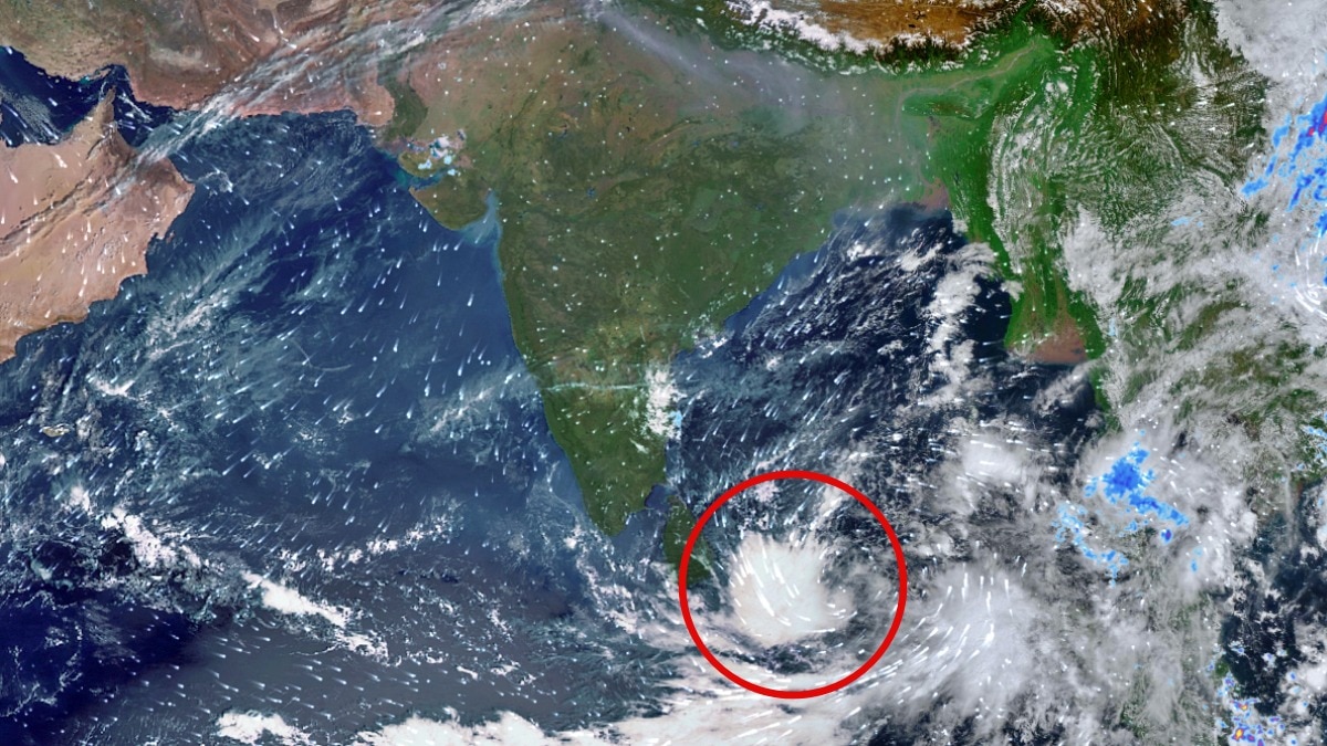
INSAT-3DS has captured intense cloud activity as a low-pressure area develops over the Andaman Sea. The next 48 hours will determine whether the system intensifies beyond a depression.The satellite imagery offers a view of the developing weather system as it gathers strength over the warm tropical waters.
A new weather system is brewing over the Bay of Bengal, with satellite imagery from India's INSAT-3DS capturing intense cloud activity over the Andaman Sea and adjoining waters as a low-pressure area formed over the Southeast Bay of Bengal on Friday.The India Meteorological Department (IMD) has warned that the system could intensify into a depression by November 15, bringing squally weather and strong winds across parts of the Bay of Bengal.The latest thermal infrared images captured by the INSAT-3DS satellite on November 13 show extensive cloud formations over the southern Bay of Bengal, Andaman Sea and adjoining regions. The satellite imagery offers a view of the developing weather system.
The satellite imagery offers a view of the developing weather system as it gathers strength over the warm tropical waters. According to the IMD, the low-pressure area formed at 5:30 am IST on November 13 under the influence of an upper-air cyclonic circulation over the central Andaman Sea and adjoining Andaman and Nicobar Islands.The system is expected to move northwestwards and become a well-marked low-pressure area around November 14.
It is likely to intensify further into a depression around November 15 over the same region.STRONG WINDS OVER BAY OF BENGAL The developing system is expected to trigger rough weather across the Andaman Sea and different parts of the Bay of Bengal over the coming days.The IMD has forecast squally weather with wind speeds reaching 40-50 kmph, gusting to 60 kmph, over the Andaman Sea on November 13 and 14. Similar conditions are likely over the Southeast Bay of Bengal between November 13 and 16.As the system strengthens, wind speeds are expected to increase further.
The Southwest Bay of Bengal could experience winds reaching 45-55 kmph, gusting to 65 kmph, between November 15 and 17.Similar wind conditions are forecast over the Central Bay of Bengal on November 16 and 17.COULD THE SYSTEM BECOME A CYCLONE?While the IMD currently forecasts the system to intensify into a depression by November 15, its subsequent development will depend on atmospheric and oceanic conditions.The coming 48 hours will be crucial in determining how quickly the system consolidates and whether it strengthens further over the Bay of Bengal.The developing system also comes amid heightened activity over the Bay of Bengal, a region known for producing tropical weather systems during the post-monsoon season.The IMD is closely monitoring its movement and intensity, with further updates expected as the system evolves.- Ends