


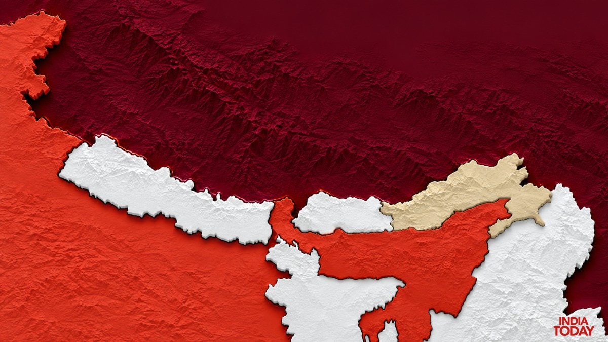
Deep in the mountains of Upper Subansiri in Arunachal Pradesh, Taksing was once reached only after days of marching. Now, reports of face-offs from this sector have put it at the centre of the India-China border debate.Last week, ITBP Director General Shatrujeet Singh Kapoor confirmed that such confrontations were continuing, saying a face-off “happened at several places in Arunachal and it continues.” Conflicting boundary maps highlight the territorial complexity around Taksing and land China has occupied since 1959 To cut through the noise, India Today’s OSINT team looked at the maps, satellite images and other open-source evidence to see what is actually there.
We traced how far India’s roads to Taksing have reached, and looked at what China has built on the other side, including in areas it has held since 1959.THE REPORTED FACE-OFFS Did Chinese troops actually walk into Indian territory here? That is the question at the heart of all these reports.
But before we can answer it, we must first settle what exactly is “Indian territory”, because here the claims run in opposite directions. Some reports said the Chinese had come 6-7 km inside.
Others went much further and spoke of 40-50 km, or compared the whole thing to the standoffs in Ladakh. In August 1959, five months after the Dalai Lama fled to India, Chinese troops attacked and captured an Indian forward picket near Longju in Arunachal Pradesh, which was then guarded by Assam Rifles Take the 6-7 km claim.
Suppose it is measured from Maja, which is mentioned in reports quoting sources. Here the direction really matters, as North of Maja lies Indian territory already under Chinese occupation for the last 67 years, where China has built up a heavy military presence and infrastructure.
To the north-west is Pukurla, the southern tip of that occupied stretch. In Maja, India has roads, helipads and troops.
If the Chinese had really crossed the Indian post at Maja, it would be more than a face-off, but we haven’t seen any evidence to suggest that. That leaves the possibility of patrols encountering each other in the west, towards Pukurla, or near Taksing.
The areas that are in focus first are Taksing, where the recent skirmishes have been reported. Further northeast lies Pukurla, which sits almost at the southern tip of the Chinese-occupied area in Arunachal Pradesh.
And beyond it, at the northern end, is Longju, a part of Indian territory that has been under Chinese occupation for the last 67 years In the areas north of Pukurla, the Chinese have increased their presence and infrastructure over the past few years, whereas Indian connectivity on the other side is relatively weaker. Near Taksing, the Chinese presence has not been as aggressively forward over the years, and local tribes were allowed to cross into Chinese-controlled territory for pilgrimage.
However, much stronger border enforcement has been reported there over the past few years. This makes Taksing the second potential candidate for a face-off between two patrolling sides.
From Longju down to the stretch opposite Taksing, there is a network of roads and modern infrastructure The other angle is the scale of Chinese movement. The available low-resolution coverage of the area is generally obstructed by green terrain, making smaller movements difficult to trace.
Even so, the imagery did not show large-scale movement similar to what was observed during the long standoff in Eastern Ladakh in 2020.News reports that attribute claims of an incursion 6-7 km inside Indian territory to official sources would help only if they provided a reference point on the LAC and a map. Without these, the whole issue stays wrapped in fog, and people are left without a clear picture of the reality.WHERE THE MAPS LET US DOWN The maps disappoint us in two ways.First, there is no clearly defined LAC in the public domain.
So where is the LAC here? Nobody knows for sure, because the LAC is only a concept.
It is not drawn on any official map, and it has never been marked on the ground. The McMahon Line was drawn on a map, but the boundary on paper does not always translate neatly onto the ground.
Even small differences in how maps depict the line can create conflicting perceptions of where the border lies Second, in Arunachal Pradesh, India treats the McMahon Line, drawn in 1914 at the Simla Convention, as its border with China. The Survey of India map draws India’s boundary using this very line.
But here comes the second letdown: both the Survey of India map and the US Geographer’s map, which also follows the McMahon Line, are inconsistent at several places and leave parts of Indian territory outside India’s boundary. McMahon Line forms the basis of India's claimed boundary in this sector, but the line shown on maps and the difficult terrain on the ground do not always translate into a clearly demarcated, easily accessible border Take Taksing, which has been at the centre of the discussion since July.
The Survey of India map leaves out at least one Indian military post, one road link under construction, and a portion of Indian territory from the area it shows as India’s. The US Geographer’s map shows these areas as part of India, but in other places it hands over some Indian territory to China.Further north-east, Pukurla and also at the northern end, Longju, where China has military and infrastructure since 1959, maps are inconsistent, and OpenStreetMap, which is publicly managed, cannot settle the question either.With this history, and no map that clearly shows where the line runs, any fresh allegation from this belt is hard to test.
The Nah Welfare Society (NWS) alleged Chinese encroachment at five locations: Oying in Asaphila, Paniar in Chujarta, Marpan, Potrang Lake and Tindingtang. The Indian Army denied the allegations and rejected any such incursions.The issue came up again when outgoing ITBP chief Shatrujeet Singh Kapoor, an IPS officer on deputation, made remarks on the situation in the region.
From what we have figured out so far, the ITBP chief was not talking about something specific but about a pattern of Chinese military activity. Patrol parties often go around, and sometimes face-offs happen at certain locations, as both countries have claims on the region.
But to say that these face-offs are so frequent that they might become Ladakh-type standoffs, we don't have evidence for that.India’s Ministry of External Affairs said that face-offs along the India-China border occur when Chinese troops “diverge from established patrolling patterns”. China said its patrols were “routine”.But beyond the question of who controls these areas, there is another challenge: how do you reach them?ROADS TO TAKSING India’s road projects range from completed links to routes still under construction or at the feasibility stage, highlighting connectivity challenges near the border India has at least seven road links planned or built around Taksing, but only one, the Tama Chung Chung (TCC)-Taksing road, is complete.
The 7 km Taksing–Ghora Camp–Lung OP road was expected by the end of 2025, but surfacing work was still being tendered in September 2026 and is now expected only in 2027. Interestingly, Lung OP falls outside the Indian territory marked on the Survey of India map.
The 95 km Huri–Taksing road is still at the feasibility study stage. Two links have foundation stones laid, and two remain proposed.
In the Longju region, India’s roads extend up to Maja, almost 5 km south of the Chinese-occupied area, and beyond that the roads thin out.On the other side, the picture is very different. From Longju down to the stretch opposite Taksing, there is a network of roads and modern infrastructure, with new villages, helipads and a forward-post complex close to the border.- Ends